2016

Cartographies of an Expedition is a study of a collection of seven rocks gathered along the course of several journeys through the North American continent, that is materialized through large format graphite drawings and site specific cartographical artifacts.
Trying to understand the stones as an abstracted landscape extraction, I carefully studied the surface of a section within these rocks and made a series of graphite drawings. Once these were finished, the area corresponding to the drawing was excavated in the rocks. Out of respect and in consideration for the geological history preceding the finding of these stones, I developed a series of cartographical artifacts, including map sections, latitude and longitude coordinates, photographs and sample textures taken at the sites.
Like in the expedition, the concepts of landmark, specimen, cartography and topography are implemented as a means to explore ideas related to material displacement, and to question the cartographical devices used to structure and understand space. These different approaches to the understanding of “landscape” are displayed in conjunction in a series of maps, objects and drawings that generate tensions between the land-scape and the law-scape, the cartographic and the geopoetic, the fluidity of the environment and the rigid construct of the geopolitic -while establishing relationships between micro and macro geographic scales.
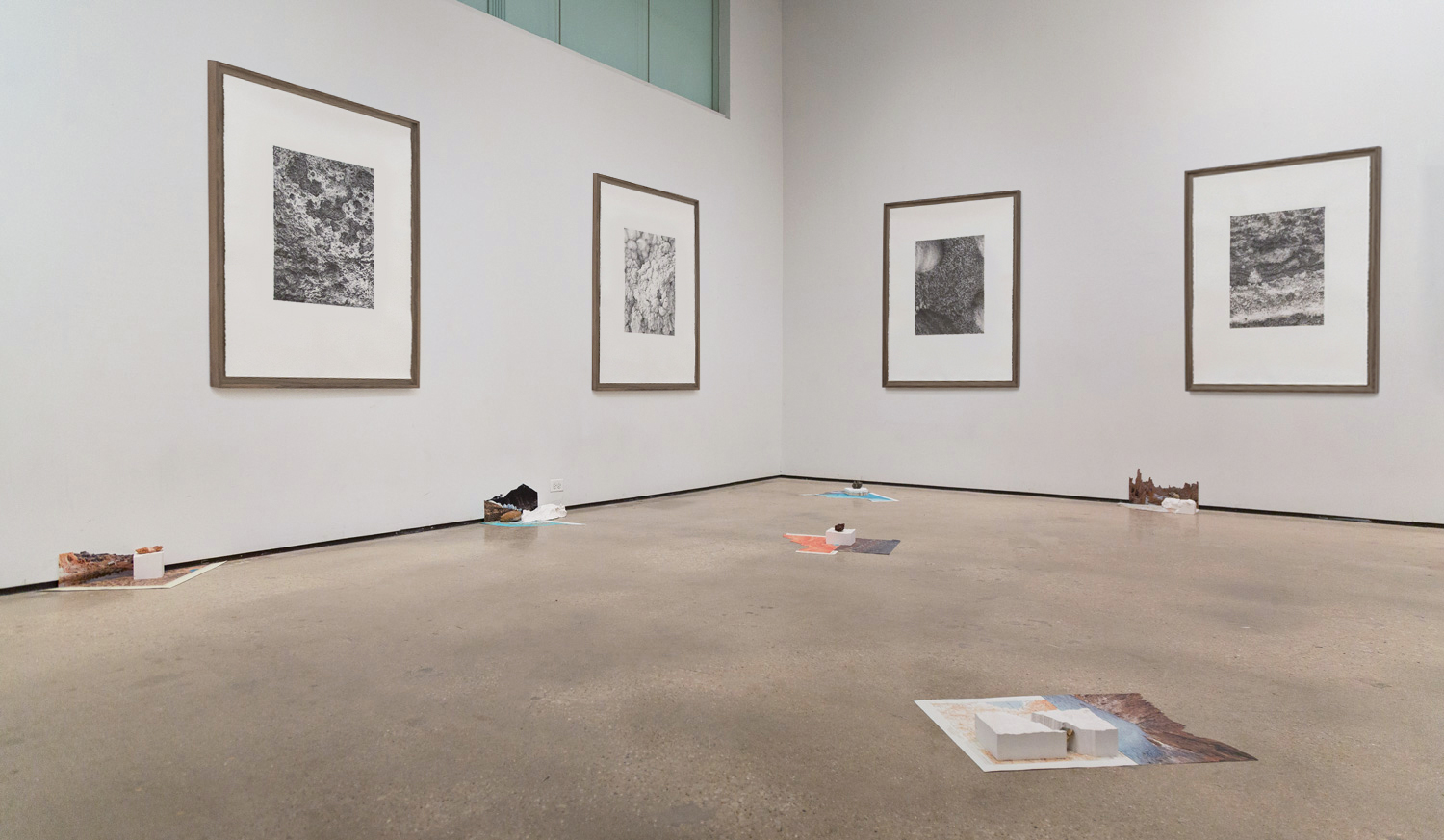
Partial view of installation from a series of seven cartographical artifacts mounted on steel plate (1,5 mm), and seven graphite drawings (127 x 97 cm)
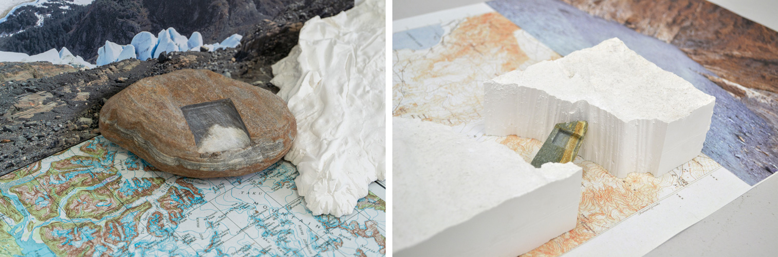
Rocks, hydrocal, historical map fragments and photographs mounted on steel plates.
.
Graphite on Legion Lenox 100 cotton paper 127 x 97 cm
Framed: 136 x 106,5 x 4,5 cm
